Community Corner
Ocean City Could See Waves From Tropical Storm Maria
The storm is on a track up the Atlantic Ocean, similar to that of Hurricane Katia.

Tropical Storm Maria appears to be following a similar path to that of Hurricane Katia, which brought several days of pounding surf to Ocean City last week.
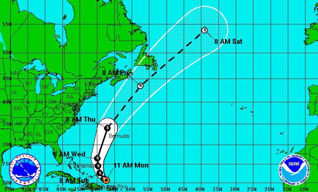
As of 11 a.m. Monday (Sept. 12), Maria was located near the Virgin Islands. Maximum sustained winds are 50 mph and extend 200 miles from the center of the storm. Little change in strength is predicted in the next 48 hours, according to the National Hurricane Center.
Forecasters project the storm will turn to the north and follow a path between Bermuda and the United States and remain over the open waters of the Atlantic Ocean.
Find out what's happening in Ocean Citywith free, real-time updates from Patch.
Maria is a weaker storm than Katia (which was a Category 1 hurricane when it passed Ocean City) and its track is expected to be slightly farther away. But the storm still holds the potential to send swells and dangerous swimming conditions to Ocean City when it passes closest on Thursday, Sept. 15.
Ocean City could start to see the surf building on Wednesday.
Find out what's happening in Ocean Citywith free, real-time updates from Patch.
Get more local news delivered straight to your inbox. Sign up for free Patch newsletters and alerts.